
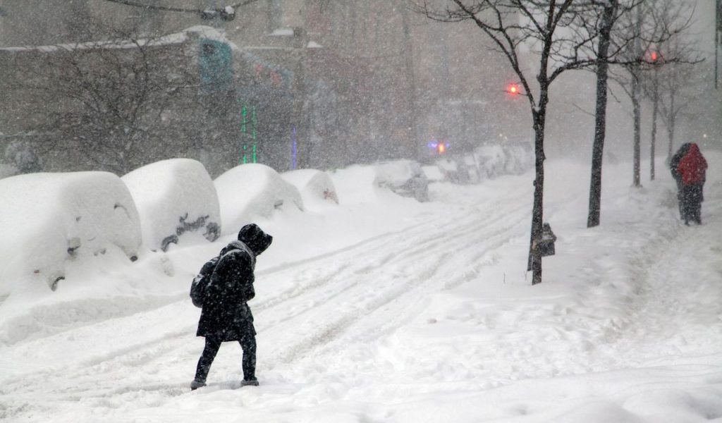
Minnesota residents woke up to a winter wonderland Wednesday morning after a powerful snowstorm swept across the state, delivering substantial snowfall totals that varied dramatically by region. The December storm, which began Tuesday afternoon and continued into early Wednesday, brought the most significant accumulations to areas north of Interstate 94, while the Twin Cities metro received a respectable coating that still impacted morning commutes. According to official measurements, Thief River Falls led the state with eight inches of fresh powder, showcasing the storm’s preference for northern communities. The system exhibited a brief pause Tuesday night before resuming with additional flurries early Wednesday, creating a two-part weather event that kept plow crews working overtime across multiple shifts.
Northern Minnesota Leads State In Snowfall
Communities situated north of I-94 bore the brunt of this winter system, with numerous towns reporting impressive snow totals that reached the upper end of forecast predictions. Thief River Falls claimed the top spot with eight inches, while nearby Grand Forks, North Dakota, wasn’t far behind at 7.4 inches. The Brainerd area saw 6.5 inches, and Forest Lake recorded a substantial seven inches that created picturesque but challenging conditions for residents. Park Rapids, Little Falls, and North Branch each measured six inches exactly, demonstrating the storm’s consistent impact across the northern tier. Wadena reported 5.5 inches, and St. Cloud officially recorded 5.6 inches. These accumulations prompted school closures and travel advisories throughout the region, as road crews worked diligently to clear highways and residential streets before the Wednesday morning rush hour began.
Twin Cities Metro Sees Varied Accumulations
The Twin Cities metropolitan area experienced more moderate but still significant snowfall that created typical winter headaches for commuters and students alike. Minneapolis proper received 5.2 inches, while St. Paul saw slightly less at 4.8 inches. The MSP Airport, a crucial weather monitoring location, recorded 4.1 inches of accumulation. Suburban communities showed interesting variations, with Blaine reporting 6.1 inches, Maple Grove at 5.3 inches, and Woodbury measuring exactly five inches. Southern suburbs generally saw lighter amounts, with Burnsville receiving 3.7 inches and Lakeville getting 3.8 inches. The varying totals across the metro reflect the storm’s patchy nature, with some areas getting brief but intense bands of snow while others experienced lighter, more consistent flurries throughout the duration of the event.
Two-Phase Storm Sets Up Bitter Cold Weekend
The storm’s progression followed a distinctive pattern that meteorologists had predicted, though the timing caught some residents by surprise. Snow began falling Tuesday afternoon and continued steadily through the evening hours before taking a temporary break overnight. This lull provided a brief window for initial cleanup efforts, but additional snow arrived before dawn on Wednesday, adding fresh layers just in time for the morning commute. The two-phase nature of the storm meant that some measurements reflect both periods of snowfall combined. Looking ahead, forecasters warn that temperatures will plunge dramatically this weekend, turning any remaining slush into ice and creating potentially hazardous conditions. Residents should prepare for bitter cold following this substantial snow event, ensuring vehicles are winterized and homes have adequate heating supplies for the upcoming Arctic blast that promises to lock Minnesota in winter’s grip.


