
A small piece of riverfront land is turning into a big city debate. At 600 Main St SE, Minneapolis must weigh new housing against decades of planning for public access along the Mississippi River.
What the city is being asked to approve

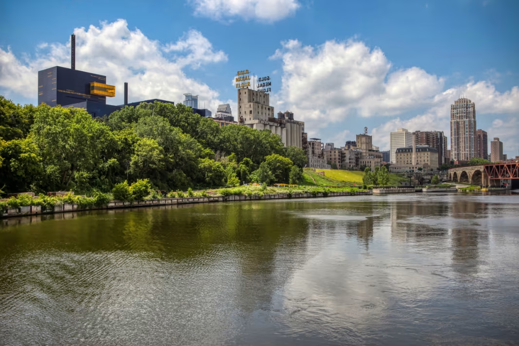
The proposal centers on 600 Main Street SE in northeast Minneapolis, where Bluff Street Development LLC wants to build a 112-unit apartment project on a site near the Mississippi River. The request goes beyond a standard development review because it includes several land use changes for the parcel. City officials are not just looking at a building, but at whether the rules for this specific site should change.
The applications include a comprehensive plan amendment that would shift the future land use designation from Parks and Open Space to Urban Neighborhood. The developer is also seeking a built form change to Corridor 6, a zoning map amendment, and a change in the Mississippi River Corridor Critical Area overlay classification from UM-1 to UM-3. In addition, the request includes setback variances along 6th Avenue SE and the southern property line.
The City Planning Commission is scheduled to consider the request at a regular meeting held at 4:30 p.m. on Monday, November 9, at the Public Service Center, 250 S 4th St, Room 350. After that hearing, the commission is expected to forward a recommendation to the Minneapolis City Council. That next step matters because zoning changes, once granted, typically stay with the parcel.
Why the site is drawing so much opposition

The strongest opposition has come from neighborhood voices who argue this parcel is different from a typical infill site. Community advocates say 600 Main St SE has long been identified in park planning as a future public riverfront space, and they want that long-term vision preserved. Their core point is simple: housing can be built in many places, but riverfront land is limited.
Opponents point to a long planning history, including the 2016 Central Mississippi Riverfront Regional Park Master Plan, the 2021 Mississippi River Corridor Critical Area ordinance, and the city’s 2040 plan guidance. They also note that, in 2009, a previous rezoning effort for the same parcel was denied after opposition from agencies and institutions including the National Park Service, the Department of Natural Resources, the Mississippi Watershed Management Organization, and the University of Minnesota.
Another major concern is precedent. Critics argue this would be the first MRCCA rezoning of its kind and could weaken the protection framework built for the river corridor. They also dispute the public value of a proposed trail easement, saying a dead-end path near Main Street would not meaningfully connect the Stone Arch Bridge to the Dinkytown Greenway without additional BNSF land.
What this decision could mean for Minneapolis

This case matters because it sits at the intersection of two big Minneapolis priorities in 2026: adding more housing and protecting the riverfront. Even some opponents say the Twin Cities need more homes, but they argue this parcel should remain under the current rules because of its location and planning history. That makes the city’s choice especially tricky.
The debate is also about permanence. A 112-unit building can be redesigned, reduced, or replaced over time, but a comprehensive plan change or rezoning can outlast a single proposal and affect future owners. That is why critics keep emphasizing that the owner may already have options to build under current zoning, including potential bonuses and conditional use permits.
For Minneapolis residents, the November 9 review is likely to be watched as a test of how firmly the city sticks to its riverfront policies. If officials back the requested changes at 600 Main St SE, supporters will see a path for more housing on a constrained site. If they reject them, it will reinforce the idea that some parts of the Mississippi riverfront are simply too important to reclassify.