
NASA’s latest Arctic sea ice maps reveal a troubling picture of how much frozen ocean disappeared during the summer of 2026. The ice reached its annual minimum on September 12, covering approximately 4.6 million square kilometers, placing the year among the lowest recorded since satellite monitoring began. While the summer minimum did not set a new record, the findings highlight a longer-term shift in the Arctic’s seasonal ice cover. Older, thicker ice continues to decline, and the region has also experienced unusually low winter ice coverage. These changes matter far beyond the Arctic, influencing ocean temperatures, Earth’s energy balance, and the climate patterns scientists are working to understand.
Arctic Sea Ice Reached Its Annual Minimum on September 12
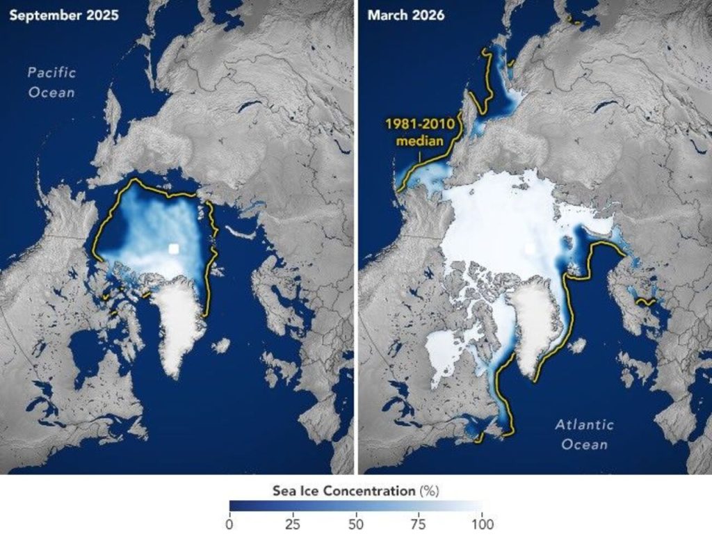
Every summer, Arctic sea ice retreats as sunlight and warmer temperatures melt the frozen seawater covering the ocean. NASA’s latest satellite observations show that the ice reached its 2026 annual minimum on September 12, marking the point when the summer melt season gave way to the return of colder conditions. The ice covered an estimated 4.6 million square kilometers, or about 1.78 million square miles, at its lowest point. This seasonal decline is a natural part of the Arctic’s annual cycle, with ice generally growing through the dark, cold winter and reaching its greatest extent in March. However, satellite records dating back to 1978 reveal a long-term decline in Arctic sea ice coverage. Although the amount of ice remaining can vary from one year to the next because of weather conditions, the overall trend shows that the Arctic is retaining less ice than it did several decades ago.
The Summer Ice Cover Fell to 4.6 Million Square Kilometers
The latest figures reveal just how much of the Arctic’s seasonal ice cover disappears during the warmer months. On September 12, 2026, sea ice covered approximately 4.6 million square kilometers of the Arctic Ocean, an area equivalent to roughly 1.78 million square miles. This measurement is known as sea ice extent, which generally includes ocean areas where at least 15% of the surface is covered by ice. It does not mean that every part of the measured area is completely frozen. NASA and the National Snow and Ice Data Center use satellite observations to track these changes across the Arctic, including areas that are difficult to observe from the ground. The September minimum remains well below the long-term average, even though recent summer measurements have been relatively stable compared with the sharp declines seen during earlier decades. Scientists continue to monitor these figures because sea ice helps regulate the Arctic climate by reflecting sunlight back into space.
The 2026 Minimum Tied for the Tenth Lowest on Record
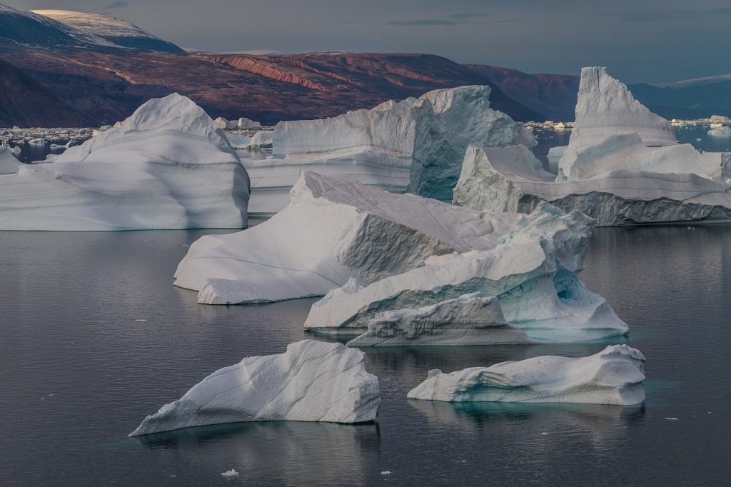
Although the 2026 summer minimum did not establish a new record low, it remained among the smallest Arctic ice covers measured since continuous satellite monitoring began in late 1978. NASA and the National Snow and Ice Data Center reported that the September 12 measurement tied with 2008, 2010, and 2025 for the tenth-lowest minimum in the satellite record. The lowest summer minimum remains the one recorded in September 2012, when Arctic sea ice shrank to approximately 3.41 million square kilometers. These year-to-year differences matter because the amount of ice that survives summer depends partly on weather patterns, including cloud cover, winds, and temperatures. A relatively high minimum in one year does not necessarily indicate that the Arctic ice cover is recovering. Instead, scientists assess the long-term pattern to understand how the region is changing. The 2026 result reinforces the broader finding that Arctic sea ice remains substantially reduced compared with earlier decades.
Every Summer Since 2007 Has Ranked Among the Twenty Lowest
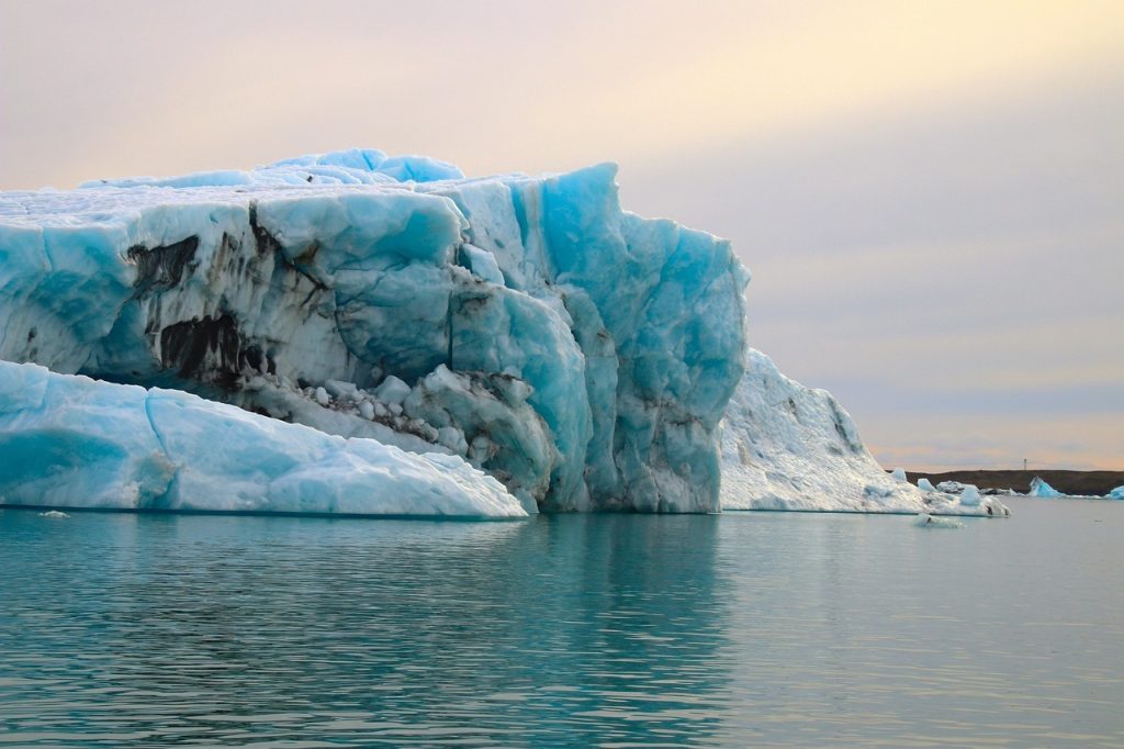
One of the most striking findings in NASA’s latest analysis is the consistency of the recent decline. Every summer from 2007 through 2026 ranks among the 20 lowest annual minimum sea ice extents recorded by satellites. That means all 20 years in this period occupy the bottom 20 positions in the nearly 48-year record. The pattern points to a major shift in the Arctic’s seasonal ice cover rather than a handful of unusually warm summers. The decline accelerated during the 2000s, when record and near-record minimums became increasingly common. More recently, September ice coverage has been relatively steady, partly because weather conditions such as increased cloud cover can limit the sunlight reaching the ice and slow melting during certain summers. However, this recent plateau has not brought Arctic sea ice back to the levels observed in the earlier satellite record. Scientists also find that rising global temperatures, alongside natural climate variability, have contributed to the long-term loss.